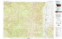
1980 Map of Hamilton
USGS Topo · Published 1997About this map
The Bitterroot River valley serves as the primary corridor for human activity on this 1980 survey, anchored by the seat at Hamilton. This narrow agricultural and residential strip stands in sharp contrast to the immense protected lands that flank it. To the west, the Selway Bitterroot Wilderness and Nez Perce National Forest cover the high country of the Bitterroot Range, while the Clearwater National Forest spans the northern reaches into Idaho.
Find a feature on this map
72 named features on this map. Tap any name to fly to it.
Don’t see what you’re looking for? This feature index may not catch every label — zoom into the map to look around manually.
Map Details
Editions of this 1980 Hamilton Map
2 editions found
Other maps of this area

1901 · Hamilton
USGS Topo · 1:125,000

1903 · Bonner
USGS Topo · 1:125,000

1909 · Sapphire
USGS Topo · 1:125,000

1911 · Lolo
USGS Topo · 1:250,000

1912 · Missoula
USGS Topo · 1:125,000

1913 · Lolo
USGS Topo · 1:250,000

1947 · Butte
USGS Topo · 1:250,000

1955 · Dillon
USGS Topo · 1:250,000

1956 · Elk City
USGS Topo · 1:250,000

1956 · Hamilton
USGS Topo · 1:250,000