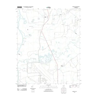
2012 Map of Hamilton
USGS Topo · Published 2012About this map
The Tombigbee River and Buttahatchee River dominate this Monroe County landscape, defining the geographic character of the region with prominent features like Travis Lott Bend and Horseshoe Bend. To the north, the split between Hamilton and New Hamilton reflects local settlement patterns, while the southern reach is anchored by the presence of Columbus Air Force Base. The area serves as a significant energy corridor, evidenced by the extensive McKinley Creek Gas Field, Hamilton Gas Field, and Maple Branch Gas Field.
Find a feature on this map
74 named features on this map. Tap any name to fly to it.
Don’t see what you’re looking for? This feature index may not catch every label — zoom into the map to look around manually.
Map Details
Editions of this 2012 Hamilton Map
This is the sole edition of this map. No revisions or reprints were ever made.
Other maps of this area

1953 · West Point
USGS Topo · 1:250,000

1958 · West Point
USGS Topo · 1:250,000

1959 · West Point
USGS Topo · 1:62,500

1960 · Caledonia
USGS Topo · 1:62,500

1963 · West Point
USGS Topo · 1:250,000

1966 · Aberdeen
USGS Topo · 1:24,000

1966 · Amory SW
USGS Topo · 1:24,000

1966 · Amory SE
USGS Topo · 1:24,000

1982 · West Point
USGS Topo · 1:100,000

1984 · West Point
USGS Topo · 1:250,000