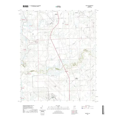
2018 Map of Hamilton
USGS Topo · Published 2018About this map
Columbus AFB dominates the southern landscape of this Monroe and Lowndes County borderland, its expansive runways and facilities situated just south of the winding Buttahatchee River. This 2018 survey illustrates a complex network of waterways where the river meets the Tombigbee River system, characterized by numerous man-made channels such as the New Hamilton Cutoff and Barton Ferry Cutoff. These engineering efforts reflect long-standing water management and navigation projects in the region.
Find a feature on this map
92 named features on this map. Tap any name to fly to it.
Don’t see what you’re looking for? This feature index may not catch every label — zoom into the map to look around manually.
Map Details
Editions of this 2018 Hamilton Map
This is the sole edition of this map. No revisions or reprints were ever made.
Other maps of this area

1953 · West Point
USGS Topo · 1:250,000

1958 · West Point
USGS Topo · 1:250,000

1959 · West Point
USGS Topo · 1:62,500

1960 · Caledonia
USGS Topo · 1:62,500

1963 · West Point
USGS Topo · 1:250,000

1966 · Aberdeen
USGS Topo · 1:24,000

1966 · Amory SW
USGS Topo · 1:24,000

1966 · Amory SE
USGS Topo · 1:24,000

1982 · West Point
USGS Topo · 1:100,000

1984 · West Point
USGS Topo · 1:250,000