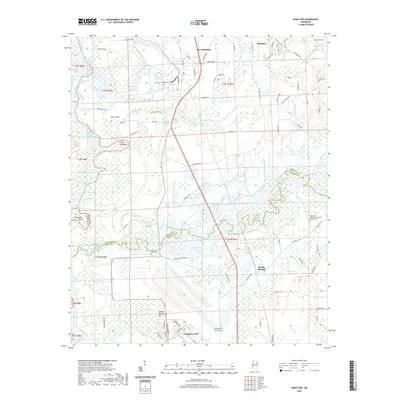
2020 Map of Hamilton
USGS Topo · Published 2020About this map
Columbus Air Force Base dominates the southern portion of this landscape, its structured layout of Simler Blvd and Hape Blvd standing in sharp contrast to the surrounding Mississippi wetlands. To the north, the Tombigbee River snakes through the terrain, leaving behind a complex network of cutoffs and bends such as Horseshoe Bend and the Vinton Cutoff. These hydrological features illustrate the river's dynamic history of shifting channels and man-made navigation improvements.
Find a feature on this map
95 named features on this map. Tap any name to fly to it.
Don’t see what you’re looking for? This feature index may not catch every label — zoom into the map to look around manually.
Map Details
Editions of this 2020 Hamilton Map
This is the sole edition of this map. No revisions or reprints were ever made.
Other maps of this area

1953 · West Point
USGS Topo · 1:250,000

1958 · West Point
USGS Topo · 1:250,000

1959 · West Point
USGS Topo · 1:62,500

1960 · Caledonia
USGS Topo · 1:62,500

1963 · West Point
USGS Topo · 1:250,000

1966 · Aberdeen
USGS Topo · 1:24,000

1966 · Amory SW
USGS Topo · 1:24,000

1966 · Amory SE
USGS Topo · 1:24,000

1982 · West Point
USGS Topo · 1:100,000

1984 · West Point
USGS Topo · 1:250,000