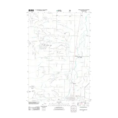
2011 Map of Hamilton North
USGS Topo · Published 2011About this map
The Bitterroot River valley floor dominates this landscape, where the agricultural flats of Poverty Flat meet the residential and civic developments of the early 21st century. The map centers on the community of Pinesdale, characterized by a grid of streets like Bull Pine Rd and Meadow Creek Rd, and supported by local institutions such as the Pinesdale Vol Fire Dept and Pinesdale Cemetery. To the east, the historic site of Cantonment Stevens sits near the river, marking an era of early military presence in the valley.
Find a feature on this map
135 named features on this map. Tap any name to fly to it.
Don’t see what you’re looking for? This feature index may not catch every label — zoom into the map to look around manually.
Map Details
Editions of this 2011 Hamilton North Map
This is the sole edition of this map. No revisions or reprints were ever made.
Other maps of this area

1901 · Hamilton
USGS Topo · 1:125,000

1956 · Hamilton
USGS Topo · 1:250,000

1959 · Hamilton
USGS Topo · 1:250,000

1960 · Hamilton
USGS Topo · 1:250,000

1964 · Hamilton
USGS Topo · 1:250,000

1964 · Hamilton South
USGS Topo · 1:24,000

1964 · Ward Mountain
USGS Topo · 1:24,000
1964 · Mountain House
USGS Topo · 1:24,000
1966 · Printz Ridge
USGS Topo · 1:24,000
1966 · Gash Point
USGS Topo · 1:24,000