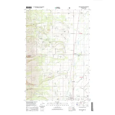
2017 Map of Hamilton North
USGS Topo · Published 2017About this map
The Bitterroot River valley anchors this 2017 survey, showing the transition from the canyon-cut slopes of the Bitterroot National Forest to the developed flats of the Bitterroot Valley. The settlement of Pinesdale is situated at the edge of the forest, where local history is marked by the Pinesdale Cem and the rugged geography of Sheridan Gulch. To the east, the landscape opens into Poverty Flat and the riverside communities of Woodside and Riverside.
Find a feature on this map
110 named features on this map. Tap any name to fly to it.
Don’t see what you’re looking for? This feature index may not catch every label — zoom into the map to look around manually.
Map Details
Editions of this 2017 Hamilton North Map
This is the sole edition of this map. No revisions or reprints were ever made.
Other maps of this area

1901 · Hamilton
USGS Topo · 1:125,000

1956 · Hamilton
USGS Topo · 1:250,000

1959 · Hamilton
USGS Topo · 1:250,000

1960 · Hamilton
USGS Topo · 1:250,000

1964 · Hamilton
USGS Topo · 1:250,000

1964 · Hamilton South
USGS Topo · 1:24,000

1964 · Ward Mountain
USGS Topo · 1:24,000
1964 · Mountain House
USGS Topo · 1:24,000
1966 · Printz Ridge
USGS Topo · 1:24,000
1966 · Gash Point
USGS Topo · 1:24,000