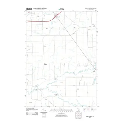
2011 Map of Hamilton West
USGS Topo · Published 2011About this map
The Kalamazoo River and its major tributaries, including the Rabbit River and the South Branch Macatawa River, define the agricultural and riparian landscape of Allegan County in this 2011 survey. The map details a transition from the aviation activity at Tulip City Airport in the north to the historic river landings further south, such as Old Squaw Skin Landing. Settlement patterns are anchored by small communities like Hamilton, Overisel, and New Richmond, each maintaining deep local roots evidenced by numerous burial grounds including the Old Overisel Cemetery and Riverside Cemetery. The drainage of the land is meticulously documented through features like Roelofs Gully, Lugten Gully, and Mann Creek, which feed into the larger river systems. This modern topographic study offers a clear look at how long-standing family farms and rural crossroads have persisted alongside newer infrastructure and the preserved wetlands of Little Dailey Bayou.
Find a feature on this map
58 named features on this map. Tap any name to fly to it.
Don’t see what you’re looking for? This feature index may not catch every label — zoom into the map to look around manually.
Map Details
Editions of this 2011 Hamilton West Map
This is the sole edition of this map. No revisions or reprints were ever made.
Other maps of this area

1928 · Fennville
USGS Topo · 1:62,500

1929 · Holland
USGS Topo · 1:62,500

1931 · Fennville
USGS Topo · 1:62,500

1932 · Holland
USGS Topo · 1:62,500

1958 · Allegan
USGS Topo · 1:62,500

1958 · Grandville
USGS Topo · 1:62,500

1958 · Racine
USGS Topo · 1:250,000

1958 · Grand Rapids
USGS Topo · 1:250,000

1961 · Grand Rapids
USGS Topo · 1:250,000

1962 · Grand Rapids
USGS Topo · 1:250,000