
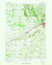
1958 Map of Grandville
USGS Topo · Published 1959About this map
The Grand River meanders through the heart of this landscape, anchoring a region defined by the transition from the growing urban edges of Grandville and Jenison to the productive agricultural lands of Ottawa and Allegan counties. In the late 1950s, the Chesapeake and Ohio railroad cuts diagonally across the terrain, linking the bustling centers of Hudsonville and Zeeland. This period shows a dense network of local institutions that supported these tight-knit communities, including the Christian Reformed Sch and numerous country churches like South Blendon Ch.
Find a feature on this map
84 named features on this map. Tap any name to fly to it.
Don’t see what you’re looking for? This feature index may not catch every label — zoom into the map to look around manually.
Map Details
Editions of this 1958 Grandville Map
2 editions found
Other maps of this area

1914 · Grand Rapids
USGS Topo · 1:62,500

1918 · Cedar Springs
USGS Topo · 1:62,500

1928 · Fennville
USGS Topo · 1:62,500

1929 · Holland
USGS Topo · 1:62,500

1930 · Muskegon
USGS Topo · 1:62,500

1931 · Fennville
USGS Topo · 1:62,500

1932 · Holland
USGS Topo · 1:62,500

1936 · Muskegon
USGS Topo · 1:62,500

1943 · Cedar Springs
USGS Topo · 1:62,500

1943 · Grand Rapids
USGS Topo · 1:62,500