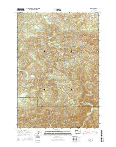
2014 Map of Hamlet
USGS Topo · Published 2014About this map
Hamlet serves as the namesake settlement for this interior region of the Coast Range, where the Clatsop Co and Tillamook Co line intersects the winding course of the North Fork Nehalem River. The landscape is defined by its dramatic relief and intricate hydrology, with numerous smaller tributaries like Fall Cr, Lost Cr, and Sweet Home Cr carving through high terrain such as Cole Mtn and Rector Ridge.
Find a feature on this map
90 named features on this map. Tap any name to fly to it.
Don’t see what you’re looking for? This feature index may not catch every label — zoom into the map to look around manually.
Map Details
Editions of this 2014 Hamlet Map
This is the sole edition of this map. No revisions or reprints were ever made.
Other maps of this area

1937 · Nehalem
USGS Topo · 1:62,500

1937 · Enright
USGS Topo · 1:62,500

1939 · Saddle Mountain
USGS Topo · 1:62,500

1940 · Cape Falcon
USGS Topo · 1:62,500

1941 · Enright
USGS Topo · 1:62,500

1943 · Nehalem
USGS Topo · 1:62,500

1943 · Saddle Mtn.
USGS Topo · 1:62,500

1948 · Vancouver
USGS Topo · 1:250,000

1950 · Vancouver
USGS Topo · 1:250,000

1950 · Vancouver
USGS Topo · 1:250,000