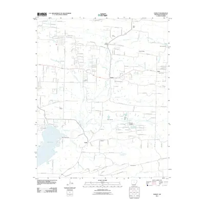
2011 Map of Hamlet
USGS Topo · Published 2011About this map
Lake Conway and its numerous small tributaries dominate the lower elevations of this Faulkner County landscape. The area is characterized by a pattern of small settlements and rural homesteads, with larger communities at Saltillo and Hamlet serving as local anchors. In the northern reaches, the terrain rises toward Berry Gap and Roden Mill Gap, while Cadron Ridge stretches across the northeastern corner, shaping the drainage of Palarm Creek and its various branches. The presence of multiple burial grounds, including Liberty Cemetery, New Liberty Cemetery, and Oak Bowery Cemetery, provides significant data for local history and genealogy. Notable aviation and recreation landmarks such as Poes Airport and Art Pond Landing reflect the mix of private enterprise and outdoor life in this part of central Arkansas. Further south, the landscape levels off as Little Cypress Creek and Panther Creek flow toward the wetlands of Bayou Meto.
Find a feature on this map
144 named features on this map. Tap any name to fly to it.
Don’t see what you’re looking for? This feature index may not catch every label — zoom into the map to look around manually.
Map Details
Editions of this 2011 Hamlet Map
This is the sole edition of this map. No revisions or reprints were ever made.
Other maps of this area

1891 · Little Rock
USGS Topo · 1:125,000

1893 · Little Rock
USGS Topo · 1:125,000

1941 · Olmstead
USGS Topo · 1:31,680

1953 · Cato
USGS Topo · 1:24,000

1953 · Mayflower
USGS Topo · 1:24,000

1954 · Olmstead
USGS Topo · 1:24,000

1955 · Little Rock
USGS Topo · 1:250,000

1956 · Little Rock
USGS Topo · 1:250,000

1956 · Russellville
USGS Topo · 1:250,000

1960 · Little Rock
USGS Topo · 1:250,000