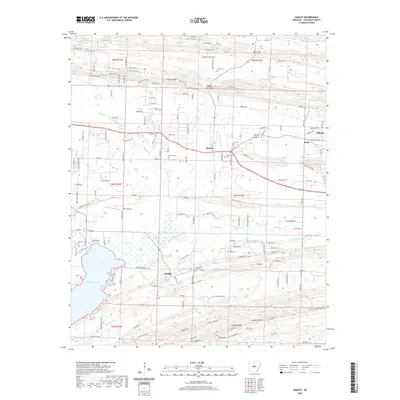
2020 Map of Hamlet
USGS Topo · Published 2020About this map
Cadron Ridge and Berry Gap define the northern terrain of this Faulkner County landscape, where the settlements of Hamlet and Beryl sit at a geographic crossroads. The map reveals a dense network of country roads and family-named landmarks, such as Hill Farm Rd and Roden Mill Rd, which trace the established boundaries between T6N and T5N. The southern portion of the sheet is dominated by the northern reaches of Lake Conway and the wetlands surrounding Little Cypress Cr. Genealogists will find significant value in the distribution of community burial grounds, including Liberty Cem, New Liberty Cem, and Oak Bowery Cem. Further south, the map documents the area near Saltillo, where Panther Cr and Bayou Meto drain towards the edge of the quadrangle. The presence of Poe's Airport and numerous rural residential loops indicates a transition from traditional agricultural land to more modern rural development.
Find a feature on this map
111 named features on this map. Tap any name to fly to it.
Don’t see what you’re looking for? This feature index may not catch every label — zoom into the map to look around manually.
Map Details
Editions of this 2020 Hamlet Map
This is the sole edition of this map. No revisions or reprints were ever made.
Other maps of this area

1891 · Little Rock
USGS Topo · 1:125,000

1893 · Little Rock
USGS Topo · 1:125,000

1941 · Olmstead
USGS Topo · 1:31,680

1953 · Cato
USGS Topo · 1:24,000

1953 · Mayflower
USGS Topo · 1:24,000

1954 · Olmstead
USGS Topo · 1:24,000

1955 · Little Rock
USGS Topo · 1:250,000

1956 · Little Rock
USGS Topo · 1:250,000

1956 · Russellville
USGS Topo · 1:250,000

1960 · Little Rock
USGS Topo · 1:250,000