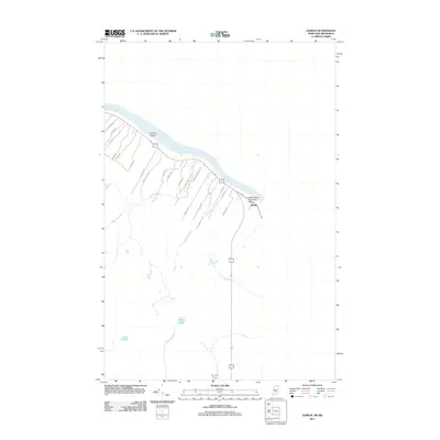
2011 Map of Hamlin
USGS Topo · Published 2011About this map
The Saint John River defines the northern edge of this borderland landscape, winding past Sixmile Island and the Upper Saint John River Valley. Near the riverbank, the community of Hamlin serves as a focal point for a network of rural roads that carry distinct local family names, such as Armand Morrow Rd, Laplante Rd, and St Pierre Rd. These routes track the movement of residents through a terrain defined by its water systems, including Martin Brook and Boney Brook which flow north toward the international boundary. Further south, the landscape transitions into a series of secluded water bodies, notably Mud Lake, Deer Lake, and Gerard Pond. This 2011 survey documents a sparsely populated region where the orientation of roads and settlements remains intimately tied to the river's path and the drainage of its many supporting brooks like Willard Brook and Lavoie Brook.
Find a feature on this map
29 named features on this map. Tap any name to fly to it.
Don’t see what you’re looking for? This feature index may not catch every label — zoom into the map to look around manually.
Map Details
Editions of this 2011 Hamlin Map
This is the sole edition of this map. No revisions or reprints were ever made.
Other maps of this area

1921 · Van Buren
USGS Topo · 1:250,000

1930 · Fort Fairfield
USGS Topo · 1:48,000

1931 · Van Buren
USGS Topo · 1:48,000

1933 · Fort Fairfield
USGS Topo · 1:62,500

1934 · Van Buren
USGS Topo · 1:62,500

1951 · Van Buren
USGS Topo · 1:62,500

1951 · Fort Fairfield
USGS Topo · 1:62,500

1953 · Fort Fairfield NW
USGS Topo · 1:24,000
1953 · Limestone
USGS Topo · 1:24,000

1959 · Woodstock
USGS Topo · 1:250,000