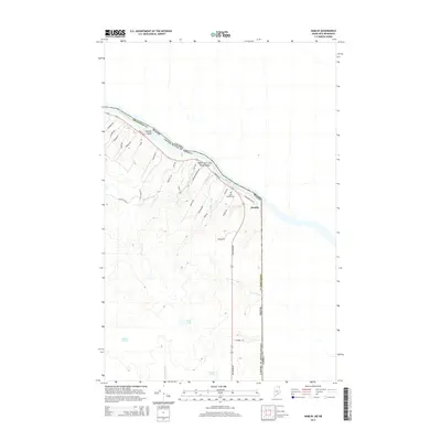
2014 Map of Hamlin
USGS Topo · Published 2014About this map
The Saint John River forms a sweeping international boundary in this northern Aroostook County landscape, separating the settlement of Hamlin and the Upper Saint John River Valley from Canada. The terrain is defined by a network of drainage ways including Martin Brook, Boney Brook, and Lavoie Brook, which carve through the elevations of Doyle Ridge. To the south, the landscape transitions into a more hydrologically diverse area featuring Mud Lake, Deer Lake, and Gerard Pond.
Find a feature on this map
40 named features on this map. Tap any name to fly to it.
Don’t see what you’re looking for? This feature index may not catch every label — zoom into the map to look around manually.
Map Details
Editions of this 2014 Hamlin Map
This is the sole edition of this map. No revisions or reprints were ever made.
Other maps of this area

1921 · Van Buren
USGS Topo · 1:250,000

1930 · Fort Fairfield
USGS Topo · 1:48,000

1931 · Van Buren
USGS Topo · 1:48,000

1933 · Fort Fairfield
USGS Topo · 1:62,500

1934 · Van Buren
USGS Topo · 1:62,500

1951 · Van Buren
USGS Topo · 1:62,500

1951 · Fort Fairfield
USGS Topo · 1:62,500

1953 · Fort Fairfield NW
USGS Topo · 1:24,000
1953 · Limestone
USGS Topo · 1:24,000

1959 · Woodstock
USGS Topo · 1:250,000