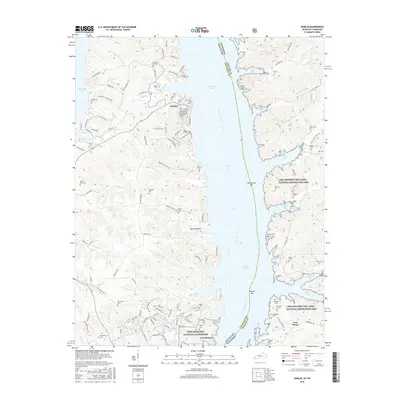
2016 Map of Hamlin
USGS Topo · Published 2016About this map
Fort Heiman and the northern reaches of Fort Donelson National Battlefield anchor the southern landscape of this 2016 survey, where the Tennessee River and Kentucky Lake define the border between Kentucky and Tennessee. The map illustrates a region heavily shaped by federal management and historic preservation, with the Land Between the Lakes National Recreation Area occupying the eastern peninsula. Numerous small family cemeteries like McCuiston Cem, Vinson Cem, and Ferguson Cem are scattered across the hills, offering a valuable record for genealogists researching the settlement patterns of Calloway and Stewart counties. The settlement of Hamlin sits at a crossroads west of the lake, surrounded by a complex system of inlets and creeks including Blood River and Yellow Spring Br. This modern survey provides a clear look at the contemporary road network, including Winchester Cemetery Rd and Riverside Dr, while preserving the locations of Civil War-era sites like Fort Henry.
Find a feature on this map
133 named features on this map. Tap any name to fly to it.
Don’t see what you’re looking for? This feature index may not catch every label — zoom into the map to look around manually.
Map Details
Editions of this 2016 Hamlin Map
This is the sole edition of this map. No revisions or reprints were ever made.
Other maps of this area

1936 · Buchanan
USGS Topo · 1:24,000

1936 · Tharpe
USGS Topo · 1:24,000

1936 · New Concord
USGS Topo · 1:24,000

1936 · Hamlin
USGS Topo · 1:24,000

1936 · Centerville Landing
USGS Topo · 1:24,000

1936 · Rushing
USGS Topo · 1:24,000

1936 · Standing Rock
USGS Topo · 1:24,000

1936 · Hico
USGS Topo · 1:24,000

1942 · New Concord
USGS Topo · 1:24,000

1942 · Hico
USGS Topo · 1:24,000