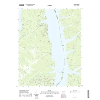
2019 Map of Hamlin
USGS Topo · Published 2019About this map
Fort Heiman and the southern reaches of the Fort Donelson National Battlefield stand as prominent landmarks on this survey of the Tennessee and Kentucky borderlands. Situated along the western banks of Kentucky Lake, the landscape is defined by its deep relationship with the water, where numerous family-named inlets like Hughes Bay and Tischel Bay carve into the shoreline. The settlement of Hamlin serves as a central point in a region densely populated with small family burial grounds, including the Stilley-McCuiston Cem, Blood River Cem, and Lassiter Cem. This concentration of cemeteries provides a significant geographic record for genealogists tracing families in Calloway County and Stewart County. The terrain is marked by distinct features such as Pine Bluff and Bailey Hollow, while the winding course of Yellow Spring Br and Shannon Cr drain into the vast reservoir created by the damming of the Tennessee River.
Find a feature on this map
137 named features on this map. Tap any name to fly to it.
Don’t see what you’re looking for? This feature index may not catch every label — zoom into the map to look around manually.
Map Details
Editions of this 2019 Hamlin Map
This is the sole edition of this map. No revisions or reprints were ever made.
Other maps of this area

1936 · Buchanan
USGS Topo · 1:24,000

1936 · Tharpe
USGS Topo · 1:24,000

1936 · New Concord
USGS Topo · 1:24,000

1936 · Hamlin
USGS Topo · 1:24,000

1936 · Centerville Landing
USGS Topo · 1:24,000

1936 · Rushing
USGS Topo · 1:24,000

1936 · Standing Rock
USGS Topo · 1:24,000

1936 · Hico
USGS Topo · 1:24,000

1942 · New Concord
USGS Topo · 1:24,000

1942 · Hico
USGS Topo · 1:24,000