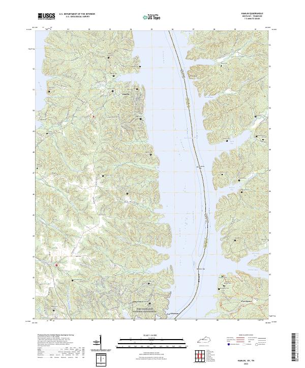
2022 Map of Hamlin
USGS Topo · Published 2022About this map
Fort Donelson National Battlefield anchors the southern shore of this terrain where the Tennessee River broadens into the expansive Kentucky Lake. The landscape is a complex network of deep inlets and bays, including Byrd Bay, Hughes Bay, and Tischel Bay, separated by narrow ridges. This geography reflects the mid-century inundation of the river valley, which transformed the local topography into a series of fingers and peninsulas.
Find a feature on this map
137 named features on this map. Tap any name to fly to it.
Don’t see what you’re looking for? This feature index may not catch every label — zoom into the map to look around manually.
Map Details
Editions of this 2022 Hamlin Map
This is the sole edition of this map. No revisions or reprints were ever made.
Other maps of this area

1936 · Buchanan
USGS Topo · 1:24,000

1936 · Tharpe
USGS Topo · 1:24,000

1936 · New Concord
USGS Topo · 1:24,000

1936 · Hamlin
USGS Topo · 1:24,000

1936 · Centerville Landing
USGS Topo · 1:24,000

1936 · Rushing
USGS Topo · 1:24,000

1936 · Standing Rock
USGS Topo · 1:24,000

1936 · Hico
USGS Topo · 1:24,000

1942 · New Concord
USGS Topo · 1:24,000

1942 · Hico
USGS Topo · 1:24,000