
1972 Map of Hamlin Well
USGS Topo · Published 1974About this map
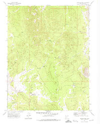
Miller Mountain stands as a prominent landmark overlooking the high desert expanse of Hamlin Valley, where the Nevada and Utah borders meet. This 1972 field-checked survey captures a remote ranching landscape defined by scattered water sources and primitive transportation routes. At the heart of the valley, Hamlin Well and an adjacent Corral mark a vital outpost for local livestock operations, situated near the intersection of several unnamed seasonal drainages. The complex drainage network of the Great Basin is clearly etched across the terrain, from the broad Hamlin Valley Wash to smaller tributaries like Cobb Creek and Wood-McCullough Creek. The presence of numerous Jeep Trails cutting through the sagebrush and mountain slopes indicates the area's continued reliance on rugged, unpaved access for land management and mineral exploration during the early 1970s.
Find a feature on this map
13 named features on this map. Tap any name to fly to it.
Don’t see what you’re looking for? This feature index may not catch every label — zoom into the map to look around manually.
Map Details
Editions of this 1972 Hamlin Well Map
This is the sole edition of this map. No revisions or reprints were ever made.
Other maps of this area

1953 · Richfield
USGS Topo · 1:250,000

1956 · Lund
USGS Topo · 1:250,000

1958 · Richfield
USGS Topo · 1:250,000

1960 · Lund
USGS Topo · 1:250,000

1971 · Mountain Home Pass
USGS Topo · 1:24,000

1972 · Gleason Basin
USGS Topo · 1:24,000

1972 · Rosencrans Knolls
USGS Topo · 1:24,000

1972 · Miller Wash
USGS Topo · 1:24,000

1972 · Hyde Well
USGS Topo · 1:24,000
1972 · Lopers Spring
USGS Topo · 1:24,000