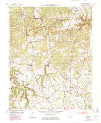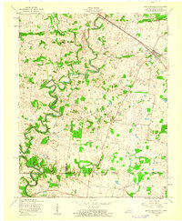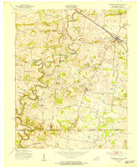
1951 Map of Hammacksville
USGS Topo · Published 1953About this map
The West Fork Red River meanders sharply through the landscape along the Kentucky-Tennessee border, anchoring a rural economy defined by small settlements and family-named landmarks. The village of Trenton serves as a local hub along the Louisville and Nashville railroad, which cuts diagonally across the northern portion of the quadrangle. This mid-century survey documents a transition from traditional mill operations to a more dispersed agricultural pattern, evidenced by the presence of Barkers Mill and an Abandoned Mine situated near the river's bends.
Find a feature on this map
24 named features on this map. Tap any name to fly to it.
Don’t see what you’re looking for? This feature index may not catch every label — zoom into the map to look around manually.
Map Details
Editions of this 1951 Hammacksville Map
This is the sole edition of this map. No revisions or reprints were ever made.
Historical Maps of Clarksville Through Time
8 maps found