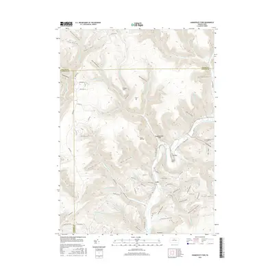
2016 Map of Hammersley Fork
USGS Topo · Published 2016About this map
Kettle Creek winds through the heart of this landscape, carving a deep valley that defines the local geography. The small settlements of Hammersley Fork and Leidy are positioned along its banks, serving as quiet hubs for the surrounding drainage basins of Trout Run and Beaverdam Run. The map reveals a densely dissected plateau, where narrow hollows like Beer Keg Hollow and Summerson Hollow lead into the high ridges of Trout Run Mtn and Roundtop. For those researching local families, the Summerson Cem is a notable landmark, while descriptive terrain names such as The Bunk and Oxbow Bend highlight the distinctive natural features that residents used to navigate this corner of north-central Pennsylvania. The extensive network of forest roads, including Montour Rd and Turkey Path Rd, illustrates the area's continued reliance on the valleys for transit and access.
Find a feature on this map
96 named features on this map. Tap any name to fly to it.
Don’t see what you’re looking for? This feature index may not catch every label — zoom into the map to look around manually.
Map Details
Editions of this 2016 Hammersley Fork Map
This is the sole edition of this map. No revisions or reprints were ever made.
Other maps of this area

1945 · Driftwood
USGS Topo · 1:48,000

1945 · First Fork
USGS Topo · 1:24,000

1945 · Sinnemahoning
USGS Topo · 1:24,000

1946 · Renovo West
USGS Topo · 1:62,500

1946 · Hammersley Fork
USGS Topo · 1:24,000

1946 · Keating
USGS Topo · 1:24,000

1946 · Tamarack
USGS Topo · 1:24,000

1946 · Renovo West
USGS Topo · 1:24,000

1947 · First Fork
USGS Topo · 1:24,000

1947 · Sinnemahoning
USGS Topo · 1:24,000
Featured Places
- Leidy Township, PA
- Wharton Township, PA
- East Keating Township, PA
- Grove Township, PA
- Hammersley Fork, Leidy Township