
1946 Map of Hammersley Fork
USGS Topo · Published 1954About this map
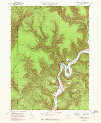
Kettle Creek snakes through the center of this 1946 field-checked survey, defining the geography of the northern Pennsylvania highlands where Potter and Clinton counties meet. The settlement pattern follows the narrow valley floors, anchored by the village of Hammersley Fork and the community of Leidy. The landscape is etched with steep drainage hollows and high points like Trout Run Mtn, while Ridge Road traverses the high ground above the many winding tributaries. Genealogy researchers can find several localized burial sites along the creek, including McCoy Cem, Calhoun Cem, and Summerson Cem, along with the Gospel Camp Ch and Central Sch. The sharp Oxbow Bend near the confluence of Walters Run illustrates the dramatic hydraulic action that shaped this isolated terrain.
Find a feature on this map
72 named features on this map. Tap any name to fly to it.
Don’t see what you’re looking for? This feature index may not catch every label — zoom into the map to look around manually.
Map Details
Editions of this 1946 Hammersley Fork Map
4 editions found
Other maps of this area

1945 · Driftwood
USGS Topo · 1:48,000

1945 · First Fork
USGS Topo · 1:24,000

1945 · Sinnemahoning
USGS Topo · 1:24,000

1946 · Renovo West
USGS Topo · 1:62,500

1946 · Keating
USGS Topo · 1:24,000

1946 · Tamarack
USGS Topo · 1:24,000

1946 · Renovo West
USGS Topo · 1:24,000

1947 · First Fork
USGS Topo · 1:24,000

1947 · Sinnemahoning
USGS Topo · 1:24,000

1947 · Conrad
USGS Topo · 1:62,500
Featured Places
- Leidy Township, PA
- Wharton Township, PA
- East Keating Township, PA
- Grove Township, PA
- Hammersley Fork, Leidy Township