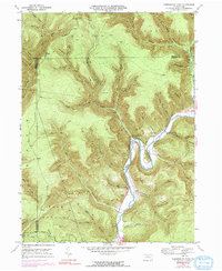
1946 Map of Hammersley Fork
USGS Topo · Published 1984About this map
Kettle Creek carves a deep, winding path through this northern Pennsylvania landscape, creating dramatic features like Oxbow Bend near the settlement of Leidy. The terrain is defined by steep ridges and narrow hollows, with Trout Run Mtn and Fork Hill rising above the converging waters. This 1946 survey, later updated with 1970s aerial data, reveals a rural community where life is organized around the creek valley and its tributaries.
Find a feature on this map
65 named features on this map. Tap any name to fly to it.
Don’t see what you’re looking for? This feature index may not catch every label — zoom into the map to look around manually.
Map Details
Editions of this 1946 Hammersley Fork Map
4 editions found
Other maps of this area

1945 · Driftwood
USGS Topo · 1:48,000

1945 · First Fork
USGS Topo · 1:24,000

1945 · Sinnemahoning
USGS Topo · 1:24,000

1946 · Renovo West
USGS Topo · 1:62,500

1946 · Hammersley Fork
USGS Topo · 1:24,000

1946 · Keating
USGS Topo · 1:24,000

1946 · Tamarack
USGS Topo · 1:24,000

1946 · Renovo West
USGS Topo · 1:24,000

1947 · First Fork
USGS Topo · 1:24,000

1947 · Sinnemahoning
USGS Topo · 1:24,000
Featured Places
- Leidy Township, PA
- Wharton Township, PA
- East Keating Township, PA
- Grove Township, PA
- Hammersley Fork, Leidy Township