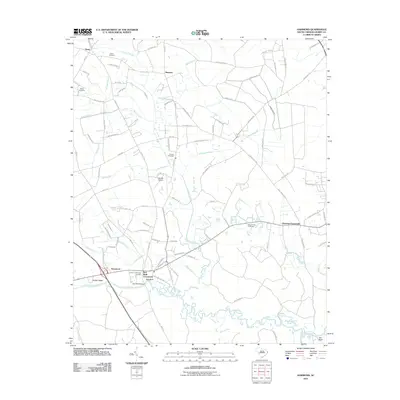
2011 Map of Hammond
USGS Topo · Published 2011About this map
Red Bluff Crossroads serves as a central point in this part of Horry County, where the landscape transitions from established agricultural settlements to the dense wetlands of the Waccamaw River valley. The map documents a network of rural communities including Hammond, Simpson, and Daisy, each connected by a winding system of roads that navigate around significant swamp features like Cowpen Swamp and Todd Swamp.
Find a feature on this map
97 named features on this map. Tap any name to fly to it.
Don’t see what you’re looking for? This feature index may not catch every label — zoom into the map to look around manually.
Map Details
Editions of this 2011 Hammond Map
This is the sole edition of this map. No revisions or reprints were ever made.
Other maps of this area

1937 · Nixonville
USGS Topo · 1:48,000

1942 · Nixonville
USGS Topo · 1:62,500

1943 · Pireway
USGS Topo · 1:31,680

1943 · Wampee
USGS Topo · 1:24,000

1944 · Longs
USGS Topo · 1:31,680

1949 · Georgetown
USGS Topo · 1:250,000

1953 · Longs
USGS Topo · 1:24,000
1953 · Pireway
USGS Topo · 1:24,000

1953 · Florence
USGS Topo · 1:250,000

1954 · Florence
USGS Topo · 1:250,000