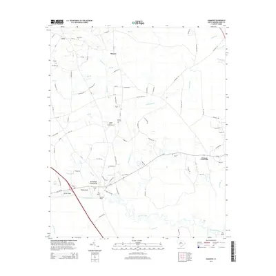
2014 Map of Hammond
USGS Topo · Published 2014About this map
The Waccamaw River winds through the southern reaches of this Horry County landscape, where low-lying wetlands like Todd Swamp and Mill Swamp dictate the pattern of settlement. Inland from the river, the terrain is characterized by a network of crossroads communities and family-named landmarks. Red Bluff Crossroads and Chestnut Crossroads serve as central nodes for the surrounding rural homesteads, while the Red Bluff Bridge provides a critical crossing point over the river near Hammond.
Find a feature on this map
92 named features on this map. Tap any name to fly to it.
Don’t see what you’re looking for? This feature index may not catch every label — zoom into the map to look around manually.
Map Details
Editions of this 2014 Hammond Map
This is the sole edition of this map. No revisions or reprints were ever made.
Other maps of this area

1937 · Nixonville
USGS Topo · 1:48,000

1942 · Nixonville
USGS Topo · 1:62,500

1943 · Pireway
USGS Topo · 1:31,680

1943 · Wampee
USGS Topo · 1:24,000

1944 · Longs
USGS Topo · 1:31,680

1949 · Georgetown
USGS Topo · 1:250,000

1953 · Longs
USGS Topo · 1:24,000
1953 · Pireway
USGS Topo · 1:24,000

1953 · Florence
USGS Topo · 1:250,000

1954 · Florence
USGS Topo · 1:250,000