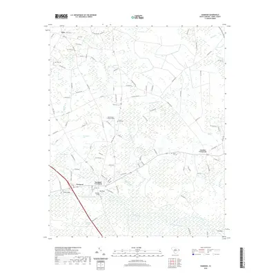
2020 Map of Hammond
USGS Topo · Published 2020About this map
The Waccamaw River winds through the lowlands of Horry County, defining the geography of this coastal plain landscape. At the heart of the area, Red Bluff Crossroads and the settlement of Red Bluff serve as traditional focal points near the Red Bluff Bridge. The map reveals a high density of family and community burial grounds, including Grainger Cem, Mount Leon Cem, and Hardee Cem, which offer significant value for genealogical research in this part of South Carolina. The terrain is characterized by extensive wetlands and named bays, such as Thoroughfare Bay and Woodward Bay, illustrating the complex drainage patterns of Cowpen Swamp and Big Swamp. Modern infrastructure like the Myrtle Beach Hardee Airpark exists alongside older established markers like Parker Lodge, showing the area's continued evolution from its river-centered roots.
Find a feature on this map
103 named features on this map. Tap any name to fly to it.
Don’t see what you’re looking for? This feature index may not catch every label — zoom into the map to look around manually.
Map Details
Editions of this 2020 Hammond Map
This is the sole edition of this map. No revisions or reprints were ever made.
Other maps of this area

1937 · Nixonville
USGS Topo · 1:48,000

1942 · Nixonville
USGS Topo · 1:62,500

1943 · Pireway
USGS Topo · 1:31,680

1943 · Wampee
USGS Topo · 1:24,000

1944 · Longs
USGS Topo · 1:31,680

1949 · Georgetown
USGS Topo · 1:250,000

1953 · Longs
USGS Topo · 1:24,000
1953 · Pireway
USGS Topo · 1:24,000

1953 · Florence
USGS Topo · 1:250,000

1954 · Florence
USGS Topo · 1:250,000