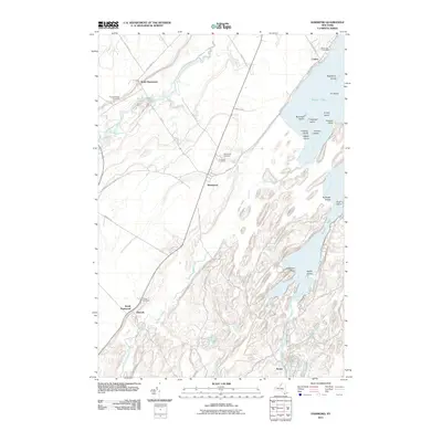
2011 Map of Hammond
USGS Topo · Published 2011About this map
Black Lake dominates the eastern landscape of this Saint Lawrence County survey, its irregular shoreline defined by numerous islands and narrow inlets. The topography is characterized by a series of northeast-trending ridges and valleys, with Black Creek and Chippewa Creek winding through the lowlands towards the St. Lawrence River just beyond the quadrangle boundary. The settlement of Hammond serves as the central hub, surrounded by smaller historical clusters such as Oakvale, Rossie, and Cedars. Genealogy researchers will find significant value in the distribution of local burial grounds, including the Fineview Cemetery near the village center and the Black Lake Cemetery further north. The map also traces the winding courses of the Indian River and Grass Creek as they approach their confluence with the lake, illustrating a landscape deeply defined by its riparian corridors and early rural road networks.
Find a feature on this map
57 named features on this map. Tap any name to fly to it.
Don’t see what you’re looking for? This feature index may not catch every label — zoom into the map to look around manually.
Map Details
Editions of this 2011 Hammond Map
This is the sole edition of this map. No revisions or reprints were ever made.
Other maps of this area

1903 · Alexandria Bay
USGS Topo · 1:62,500

1906 · Brier Hill
USGS Topo · 1:62,500

1912 · Hammond
USGS Topo · 1:62,500

1942 · Morristown
USGS Topo · 1:24,000

1943 · Morristown
USGS Topo · 1:31,680

1943 · Redwood
USGS Topo · 1:31,680

1943 · Edwardsville
USGS Topo · 1:31,680

1944 · Hammond
USGS Topo · 1:62,500

1948 · Chippewa Bay
USGS Topo · 1:24,000

1948 · Alexandria Bay
USGS Topo · 1:62,500