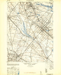
1948 Map of Hammonton
USGS Topo · Published 1948About this map
Hammonton serves as a major hub in this post-war landscape, where the dense intersection of the Pennsylvania Reading Seashore Lines and the Central Railroad of New Jersey defines the regional economy. The map illustrates a complex transit network of the late 1940s, anchored by Winslow Junction and the iconic Black Horse Pike. Surrounding the developed centers, the Pine Barrens environment is evident through numerous waterways such as Hospitality Branch and the Great Egg Harbor River, which wind through marshy lowlands like the Great Swamp Branch. Small agricultural and residential outposts like Ancora, Blue Anchor, and the interestingly named Pestletown are connected by a web of local routes, including the Horse Pike and Wheat Road, reflecting the area's transition from traditional farming and milling toward modern suburban and transit-oriented development.
Find a feature on this map
98 named features on this map. Tap any name to fly to it.
Don’t see what you’re looking for? This feature index may not catch every label — zoom into the map to look around manually.
Map Details
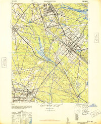
Editions of this 1948 Hammonton Map
2 editions found
Other maps of this area

1888 · Pemberton
USGS Topo · 1:62,500

1888 · Mount Holly
USGS Topo · 1:62,500

1890 · Great Egg Harbor
USGS Topo · 1:62,500

1890 · Hammonton
USGS Topo · 1:62,500

1890 · Tuckahoe
USGS Topo · 1:62,500

1890 · Bridgeton
USGS Topo · 1:62,500

1890 · Mullica
USGS Topo · 1:62,500

1890 · Glassboro
USGS Topo · 1:62,500

1891 · Philadelphia
USGS Topo · 1:62,500

1893 · Great Egg Harbor
USGS Topo · 1:62,500