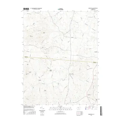
2016 Map of Hammonville
USGS Topo · Published 2016About this map
Hammonville and the surrounding rural landscapes of Larue and Hart Counties appear here during a period of modern agricultural continuity. The geography is defined by a dense network of local roads such as Hammonsville Schoolhouse Rd and Rodney Peace Rd, which connect small hubs like Maxine, Talley, and Wabash. The terrain is characterized by numerous named peaks including Three Springs Knob, Kennedy Knob, and High Hickory, providing a complex backdrop for the region's farms and small settlements.
Find a feature on this map
73 named features on this map. Tap any name to fly to it.
Don’t see what you’re looking for? This feature index may not catch every label — zoom into the map to look around manually.
Map Details
Editions of this 2016 Hammonville Map
This is the sole edition of this map. No revisions or reprints were ever made.
Other maps of this area

1934 · Munfordville
USGS Topo · 1:48,000

1935 · Elizabethtown
USGS Topo · 1:48,000

1937 · Munfordville
USGS Topo · 1:62,500

1938 · Elizabethtown
USGS Topo · 1:62,500

1949 · Sonora
USGS Topo · 1:24,000

1949 · Tonieville
USGS Topo · 1:24,000
1949 · Elizabethtown
USGS Topo · 1:62,500

1953 · Hudgins
USGS Topo · 1:24,000

1953 · Munfordville
USGS Topo · 1:24,000

1953 · Magnolia
USGS Topo · 1:24,000