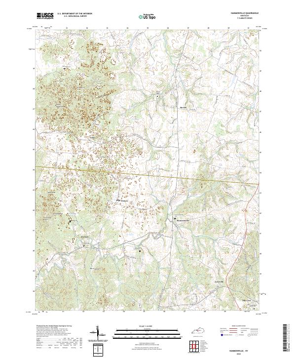
2022 Map of Hammonville
USGS Topo · Published 2022About this map
The rolling hills of the LaRue and Hart County line define this central Kentucky landscape, where small rural communities are connected by a network of winding roads. Hammonsville serves as a central junction, surrounded by outlying settlements like Talley, Wabash, and Jonesville. The area's geography is characterized by distinct knobs and hollows, such as Three Springs Knob and Barefoot Hollow, which dictate the placement of farms and cemeteries. Numerous family-named burial grounds and small churches, including Gaddie Cem, Hodge Cem, and Pike View Baptist Church Cem, are scattered throughout the quadrangle, reflecting generations of local family history. Waterways like Bacon Creek and Barren Run carve through the terrain, with names like Honey Run and Tampa Branch highlighting the importance of local drainage in this agricultural region.
Find a feature on this map
81 named features on this map. Tap any name to fly to it.
Don’t see what you’re looking for? This feature index may not catch every label — zoom into the map to look around manually.
Map Details
Editions of this 2022 Hammonville Map
This is the sole edition of this map. No revisions or reprints were ever made.
Other maps of this area

1934 · Munfordville
USGS Topo · 1:48,000

1935 · Elizabethtown
USGS Topo · 1:48,000

1937 · Munfordville
USGS Topo · 1:62,500

1938 · Elizabethtown
USGS Topo · 1:62,500

1949 · Sonora
USGS Topo · 1:24,000

1949 · Tonieville
USGS Topo · 1:24,000
1949 · Elizabethtown
USGS Topo · 1:62,500

1953 · Hudgins
USGS Topo · 1:24,000

1953 · Munfordville
USGS Topo · 1:24,000

1953 · Magnolia
USGS Topo · 1:24,000