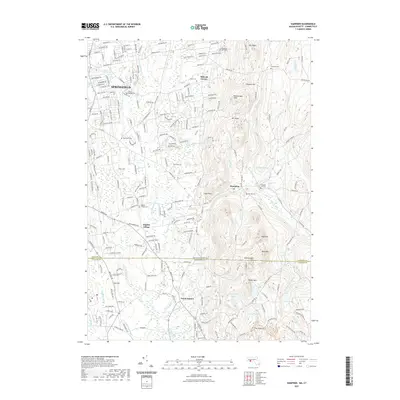
2021 Map of Hampden
USGS Topo · Published 2021About this map
Springfield and the surrounding borderlands of Massachusetts and Connecticut are defined by a complex network of waterways and prominent ridges. The Scantic River and its numerous tributaries, including Watchaug Brook and Thrasher Brook, wind through the valley floors, while significant elevations like Rattlesnake Peak and Bald Mtn rise sharply above the landscape. This 2021 survey illustrates the continued importance of historic community centers such as Baptist Village and Mileoak Corner, alongside the persistent presence of local burial grounds like The Old Cem and Prospect Hill Cem. The southern portion of the map transitions into the rolling terrain of North Somers, Connecticut, where the Shenipsit Forest Trl weaves through the wooded uplands. Numerous ponds and reservoirs, such as Worthington Pond and Cooley Pond, dot the landscape, reflecting a region where water management and conservation areas remain central to the geography of the Hampden quadrangle.
Find a feature on this map
158 named features on this map. Tap any name to fly to it.
Don’t see what you’re looking for? This feature index may not catch every label — zoom into the map to look around manually.
Map Details
Editions of this 2021 Hampden Map
This is the sole edition of this map. No revisions or reprints were ever made.
Other maps of this area

1886 · Springfield
USGS Topo · 1:62,500

1887 · Palmer
USGS Topo · 1:62,500

1889 · Springfield
USGS Topo · 1:62,500

1889 · Palmer
USGS Topo · 1:62,500

1892 · Hartford
USGS Topo · 1:62,500

1892 · Tolland
USGS Topo · 1:62,500

1893 · Springfield
USGS Topo · 1:62,500

1893 · Palmer
USGS Topo · 1:62,500

1895 · Springfield
USGS Topo · 1:62,500

1896 · Holyoke
USGS Topo · 1:125,000