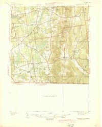
1939 Map of Hampden
USGS Topo · Published 1939About this map
Wilbraham Academy and the village of Hampden anchor this 1930s landscape along the Massachusetts-Connecticut border. The terrain is defined by a series of prominent peaks, including Minnechoag Mountain, Mt Vision, and Rattlesnake Peak, which overlook a network of valley roads and small settlements. The Scantic River and its East Branch wind through the southeastern portion of the map, while the North Branch and South Branch of the Mill River drain the western slopes toward Sixteen Acres.
Find a feature on this map
42 named features on this map. Tap any name to fly to it.
Don’t see what you’re looking for? This feature index may not catch every label — zoom into the map to look around manually.
Map Details
Editions of this 1939 Hampden Map
This is the sole edition of this map. No revisions or reprints were ever made.
Other maps of this area

1886 · Springfield
USGS Topo · 1:62,500

1887 · Palmer
USGS Topo · 1:62,500

1889 · Springfield
USGS Topo · 1:62,500

1889 · Palmer
USGS Topo · 1:62,500

1892 · Hartford
USGS Topo · 1:62,500

1892 · Tolland
USGS Topo · 1:62,500

1893 · Springfield
USGS Topo · 1:62,500

1893 · Palmer
USGS Topo · 1:62,500

1895 · Springfield
USGS Topo · 1:62,500

1896 · Holyoke
USGS Topo · 1:125,000