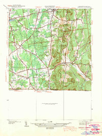
1942 Map of Hampden
USGS Topo · Published 1942About this map
Hampden and Wilbraham anchor this 1938 survey of the Pioneer Valley's eastern foothills just before the Second World War. The landscape is defined by the sharp rise of Minnechoag Mountain and the winding course of the Scantic River, which cuts a narrow valley through the center of the sheet. Notable local landmarks include the State Game Farm and the Wilbraham Academy Church, reflecting a mix of rural conservation and established educational institutions.
Find a feature on this map
47 named features on this map. Tap any name to fly to it.
Don’t see what you’re looking for? This feature index may not catch every label — zoom into the map to look around manually.
Map Details
Editions of this 1942 Hampden Map
This is the sole edition of this map. No revisions or reprints were ever made.
Other maps of this area

1886 · Springfield
USGS Topo · 1:62,500

1887 · Palmer
USGS Topo · 1:62,500

1889 · Springfield
USGS Topo · 1:62,500

1889 · Palmer
USGS Topo · 1:62,500

1892 · Hartford
USGS Topo · 1:62,500

1892 · Tolland
USGS Topo · 1:62,500

1893 · Springfield
USGS Topo · 1:62,500

1893 · Palmer
USGS Topo · 1:62,500

1895 · Springfield
USGS Topo · 1:62,500

1896 · Holyoke
USGS Topo · 1:125,000