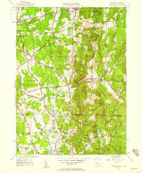
1946 Map of Hampden
USGS Topo · Published 1956About this map
Minnechoag Mountain and Rattlesnake Peak dominate the skyline of this borderland, where the wooded uplands of south-central Massachusetts meet the agricultural valleys of northern Connecticut. Centered on the village of Hampden, the landscape reveals a post-war rural character punctuated by established institutions like Wilbraham Academy and the sprawling State Game Farm. To the west, the suburban expansion of Springfield is visible in the growing street grids of Sixteen Acres and the neighborhood of Baptist Village.
Find a feature on this map
77 named features on this map. Tap any name to fly to it.
Don’t see what you’re looking for? This feature index may not catch every label — zoom into the map to look around manually.
Map Details
Editions of this 1946 Hampden Map
This is the sole edition of this map. No revisions or reprints were ever made.
Other maps of this area

1886 · Springfield
USGS Topo · 1:62,500

1887 · Palmer
USGS Topo · 1:62,500

1889 · Springfield
USGS Topo · 1:62,500

1889 · Palmer
USGS Topo · 1:62,500

1892 · Hartford
USGS Topo · 1:62,500

1892 · Tolland
USGS Topo · 1:62,500

1893 · Springfield
USGS Topo · 1:62,500

1893 · Palmer
USGS Topo · 1:62,500

1895 · Springfield
USGS Topo · 1:62,500

1896 · Holyoke
USGS Topo · 1:125,000