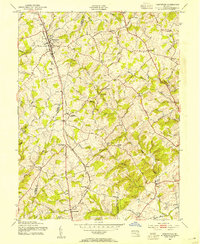
1953 Map of Hampstead
USGS Topo · Published 1954About this map
The Western Maryland railroad corridor forms the backbone of this mid-century landscape, linking a series of rural hamlets and agricultural centers along the boundary of Carroll and Baltimore counties. The settlement at Hampstead serves as a primary hub, while smaller communities like Fowblesburg, Boring, and Woodensburg follow the rail line south. The terrain is defined by a dense network of watercourses, including Piney Run and Georges Run, which carved the valleys that supported early industry such as Trenton Mill and Loes Mill.
Find a feature on this map
59 named features on this map. Tap any name to fly to it.
Don’t see what you’re looking for? This feature index may not catch every label — zoom into the map to look around manually.
Map Details
Editions of this 1953 Hampstead Map
4 editions found
Other maps of this area

1892 · Ellicott
USGS Topo · 1:62,500

1894 · Ellicott
USGS Topo · 1:62,500

1894 · Baltimore
USGS Topo · 1:62,500

1899 · Baltimore
USGS Topo · 1:62,500

1900 · Parkton
USGS Topo · 1:62,500

1902 · Parkton
USGS Topo · 1:62,500

1904 · Baltimore
USGS Topo · 1:62,500

1905 · Westminster
USGS Topo · 1:62,500

1906 · Ellicott
USGS Topo · 1:62,500

1908 · Patapsco
USGS Topo · 1:125,000