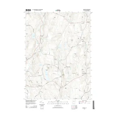
2015 Map of Hampton
USGS Topo · Published 2015About this map
The Little River and Merrick Brook systems define the geography of this part of Windham County, where the topography is marked by a series of named elevations including Lyon Hill, Bear Hill, and Pumpkin Hill. Centered on the town of Hampton, this 2015 survey shows a rural landscape of scattered hamlets and historic road corridors like Pomfret Rd and Hartford Rd. Numerous burial grounds are documented across the quadrangle, including the Old Ashford Cem in the northwest and Litchfield Cem near the town center, providing essential geographic data for genealogical research. Notable water features such as Hampton Reservoir and Pine Acres Lake are surrounded by significant wooded tracts and ridges. The settlement pattern at Rawson, Elliotts, and Howard Valley reflects the region's long-standing agricultural and residential character, maintained even as modern road networks have integrated these communities.
Find a feature on this map
149 named features on this map. Tap any name to fly to it.
Don’t see what you’re looking for? This feature index may not catch every label — zoom into the map to look around manually.
Map Details
Editions of this 2015 Hampton Map
This is the sole edition of this map. No revisions or reprints were ever made.
Other maps of this area

1889 · Putnam
USGS Topo · 1:62,500

1889 · Moosup
USGS Topo · 1:62,500

1892 · Woodstock
USGS Topo · 1:62,500

1892 · Norwich
USGS Topo · 1:62,500

1893 · Putnam
USGS Topo · 1:62,500

1893 · Moosup
USGS Topo · 1:62,500

1919 · Putnam
USGS Topo · 1:62,500

1920 · Moosup
USGS Topo · 1:62,500

1921 · Woodstock
USGS Topo · 1:62,500

1943 · Plainfield
USGS Topo · 1:31,680