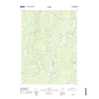
2021 Map of Hampton
USGS Topo · Published 2021About this map
Pine Acres Lake and the Natchaug River anchor this landscape in northeastern Connecticut, where the geography is defined by a dense network of brooks and glacial hills. The topography is marked by several prominent summits including Grow Hill, Paine Hill, and Trowbridge Hill, which separate the valley of the Little River from the smaller drainage basins of Bigelow Brook and Merrick Brook. This area retains a decentralized rural settlement pattern with distinct clusters at Hampton, Rawson, and Elliotts, many of which developed around early transportation routes like the Airline Trail and the Providence Tpke. Genealogists will find a significant distribution of family and community burial grounds across the township, such as Abington Cem, Benson Cem, and Chewink Cem, suggesting the long-standing agricultural and residential history of these Windham County communities.
Find a feature on this map
142 named features on this map. Tap any name to fly to it.
Don’t see what you’re looking for? This feature index may not catch every label — zoom into the map to look around manually.
Map Details
Editions of this 2021 Hampton Map
This is the sole edition of this map. No revisions or reprints were ever made.
Other maps of this area

1889 · Putnam
USGS Topo · 1:62,500

1889 · Moosup
USGS Topo · 1:62,500

1892 · Woodstock
USGS Topo · 1:62,500

1892 · Norwich
USGS Topo · 1:62,500

1893 · Putnam
USGS Topo · 1:62,500

1893 · Moosup
USGS Topo · 1:62,500

1919 · Putnam
USGS Topo · 1:62,500

1920 · Moosup
USGS Topo · 1:62,500

1921 · Woodstock
USGS Topo · 1:62,500

1943 · Plainfield
USGS Topo · 1:31,680