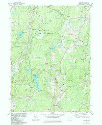
1984 Map of Hampton
USGS Topo · Published 1984About this map
Natchaug State Forest and the James L Goodwin State Forest dominate the landscape of eastern Windham County, where the Natchaug River and Little River systems dictate the local topography. This early 1980s data reveals a region of small, established settlements like Hampton and Abington connected by a network of rural routes such as Griffin Highway and Old Town Pound Road. Genealogists will find several burial grounds noted, including North Cem, South Cem, and Chewink Cem, providing vital clues for family history research in this part of Connecticut. The presence of Pine Acres Lake and Hampton Reservoir highlights the importance of water management in this wooded terrain, while landmarks like Nathaniel Lyon Memorial Park reflect the local heritage and preservation efforts of the era.
Find a feature on this map
89 named features on this map. Tap any name to fly to it.
Don’t see what you’re looking for? This feature index may not catch every label — zoom into the map to look around manually.
Map Details
Editions of this 1984 Hampton Map
This is the sole edition of this map. No revisions or reprints were ever made.
Other maps of this area

1889 · Putnam
USGS Topo · 1:62,500

1889 · Moosup
USGS Topo · 1:62,500

1892 · Woodstock
USGS Topo · 1:62,500

1892 · Norwich
USGS Topo · 1:62,500

1893 · Putnam
USGS Topo · 1:62,500

1893 · Moosup
USGS Topo · 1:62,500

1919 · Putnam
USGS Topo · 1:62,500

1920 · Moosup
USGS Topo · 1:62,500

1921 · Woodstock
USGS Topo · 1:62,500

1943 · Plainfield
USGS Topo · 1:31,680