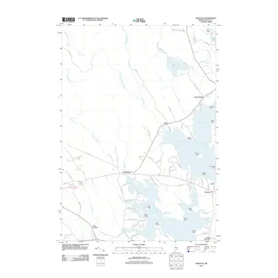
2011 Map of Hancock
USGS Topo · Published 2011About this map
Taunton Bay and the Skillings River dominate this coastal landscape, where the tides reach deep into the interior of Hancock County. The settlement at Hancock serves as a central hub, surrounded by smaller communities such as Egypt and West Franklin. The map reveals a network of coastal roads like Harvey Point Rd and Cemetery Rd that connect family-named landmarks along the jagged shoreline. Genealogists will find significant value in the documentation of several local burial grounds, including Abbott Cemetery near Georges Pond and the McFarland Hill Cemetery further inland. The transition from the dense drainage patterns of Egypt Stream and Kilkenny Stream to the expansive waters of Egypt Bay illustrates the distinct coastal geography of the Maine shoreline in the early twenty-first century.
Find a feature on this map
90 named features on this map. Tap any name to fly to it.
Don’t see what you’re looking for? This feature index may not catch every label — zoom into the map to look around manually.
Map Details
Editions of this 2011 Hancock Map
This is the sole edition of this map. No revisions or reprints were ever made.
Other maps of this area

1904 · Mount Desert
USGS Topo · 1:62,500

1904 · Bar Harbor
USGS Topo · 1:62,500

1911 · Ellsworth
USGS Topo · 1:62,500

1930 · Tunk Lake
USGS Topo · 1:48,000

1932 · Tunk Lake
USGS Topo · 1:62,500

1940 · Ellsworth
USGS Topo · 1:62,500

1942 · Bar Harbor
USGS Topo · 1:62,500

1942 · Ellsworth
USGS Topo · 1:62,500

1942 · Mount Desert
USGS Topo · 1:62,500

1942 · Tunk Lake
USGS Topo · 1:62,500