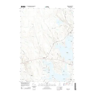
2014 Map of Hancock
USGS Topo · Published 2014About this map
Hancock and West Franklin occupy a landscape defined by the intricate coastal geometry of Downeast Maine. The settlement pattern follows the contours of Taunton Bay and the Skillings River, with residences concentrated along Us-1 and Old Route 1. This 2014 survey documents the enduring local geography of the region, where numerous coves such as Kilkenny Cove and Partridge Cove indent the shoreline, and small islands like Hills Island and Burying Island break the waters of the bays.
Find a feature on this map
100 named features on this map. Tap any name to fly to it.
Don’t see what you’re looking for? This feature index may not catch every label — zoom into the map to look around manually.
Map Details
Editions of this 2014 Hancock Map
This is the sole edition of this map. No revisions or reprints were ever made.
Other maps of this area

1904 · Mount Desert
USGS Topo · 1:62,500

1904 · Bar Harbor
USGS Topo · 1:62,500

1911 · Ellsworth
USGS Topo · 1:62,500

1930 · Tunk Lake
USGS Topo · 1:48,000

1932 · Tunk Lake
USGS Topo · 1:62,500

1940 · Ellsworth
USGS Topo · 1:62,500

1942 · Bar Harbor
USGS Topo · 1:62,500

1942 · Ellsworth
USGS Topo · 1:62,500

1942 · Mount Desert
USGS Topo · 1:62,500

1942 · Tunk Lake
USGS Topo · 1:62,500