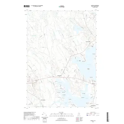
2018 Map of Hancock
USGS Topo · Published 2018About this map
Skillings River and Taunton Bay define the deeply indented coastline of this coastal region, where tidal inlets and coves create a complex interface between land and sea. The settlement pattern is concentrated along established corridors like Franklin Road and near the sheltered waters of Kilkenny Cove and Egypt Bay. Small communities such as West Franklin and North Lamoine are connected by a network of winding local roads, reflecting the traditional maritime and rural economy of Hancock County.
Find a feature on this map
97 named features on this map. Tap any name to fly to it.
Don’t see what you’re looking for? This feature index may not catch every label — zoom into the map to look around manually.
Map Details
Editions of this 2018 Hancock Map
This is the sole edition of this map. No revisions or reprints were ever made.
Other maps of this area

1904 · Mount Desert
USGS Topo · 1:62,500

1904 · Bar Harbor
USGS Topo · 1:62,500

1911 · Ellsworth
USGS Topo · 1:62,500

1930 · Tunk Lake
USGS Topo · 1:48,000

1932 · Tunk Lake
USGS Topo · 1:62,500

1940 · Ellsworth
USGS Topo · 1:62,500

1942 · Bar Harbor
USGS Topo · 1:62,500

1942 · Ellsworth
USGS Topo · 1:62,500

1942 · Mount Desert
USGS Topo · 1:62,500

1942 · Tunk Lake
USGS Topo · 1:62,500