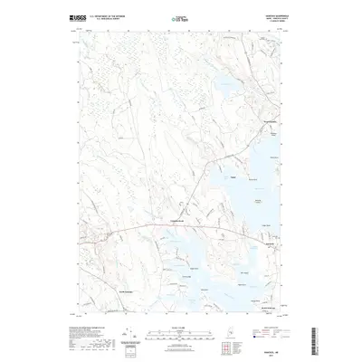
2021 Map of Hancock
USGS Topo · Published 2021About this map
Egypt Bay and the intricately carved coastline of the Skillings River define this coastal Hancock County landscape. The region's geography is dominated by a transition from the inland wetlands of Bloxton Meadow and Great Pond to the saltwater inlets of Taunton Bay. The settlement pattern follows the shorelines and historical thoroughfares, connecting the villages of Hancock and West Franklin. Small family and community landmarks, such as Riverside Cem and McFarland Hill Cem, are scattered throughout the wooded terrain, marking generations of local residents. The map illustrates a dense network of brooks and streams, including Egypt Stream and Kilkenny Stream, which feed into the larger bays. This network of waterways and points, such as Hardison Point and Seal Point, highlights the enduring maritime and rural character of the area as it transitioned into the twenty-first century.
Find a feature on this map
105 named features on this map. Tap any name to fly to it.
Don’t see what you’re looking for? This feature index may not catch every label — zoom into the map to look around manually.
Map Details
Editions of this 2021 Hancock Map
This is the sole edition of this map. No revisions or reprints were ever made.
Other maps of this area

1904 · Mount Desert
USGS Topo · 1:62,500

1904 · Bar Harbor
USGS Topo · 1:62,500

1911 · Ellsworth
USGS Topo · 1:62,500

1930 · Tunk Lake
USGS Topo · 1:48,000

1932 · Tunk Lake
USGS Topo · 1:62,500

1940 · Ellsworth
USGS Topo · 1:62,500

1942 · Bar Harbor
USGS Topo · 1:62,500

1942 · Ellsworth
USGS Topo · 1:62,500

1942 · Mount Desert
USGS Topo · 1:62,500

1942 · Tunk Lake
USGS Topo · 1:62,500