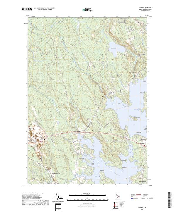
2024 Map of Hancock
USGS Topo · Published 2024About this map
Taunton Bay and the Skillings River define the intricate coastline of this Hancock County landscape, where tidal inlets like Egypt Bay and Carrying Place Inlet reach deep into the forested interior. The map illustrates a coastal economy structured around waterfront access and established road networks, with settlements concentrated at West Franklin, Hancock, and South Hancock. Significant topographical interest is found in the scattered islands and points, including the aptly named Burying Island and Hills Island.
Find a feature on this map
105 named features on this map. Tap any name to fly to it.
Don’t see what you’re looking for? This feature index may not catch every label — zoom into the map to look around manually.
Map Details
Editions of this 2024 Hancock Map
This is the sole edition of this map. No revisions or reprints were ever made.
Other maps of this area

1904 · Mount Desert
USGS Topo · 1:62,500

1904 · Bar Harbor
USGS Topo · 1:62,500

1911 · Ellsworth
USGS Topo · 1:62,500

1930 · Tunk Lake
USGS Topo · 1:48,000

1932 · Tunk Lake
USGS Topo · 1:62,500

1940 · Ellsworth
USGS Topo · 1:62,500

1942 · Bar Harbor
USGS Topo · 1:62,500

1942 · Ellsworth
USGS Topo · 1:62,500

1942 · Mount Desert
USGS Topo · 1:62,500

1942 · Tunk Lake
USGS Topo · 1:62,500