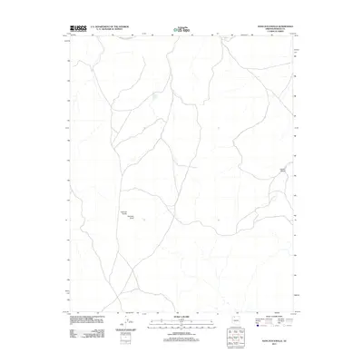
2011 Map of Hancock Knolls
USGS Topo · Published 2011About this map
The Kanab Plateau defines the arid character of this Mohave County landscape, where water sources were critical for the survival of early ranchers and travelers. Strategic water points such as School Section Tank and White Tank are marked alongside the winding route of Mount Trumbull Rd, which serves as the primary corridor through this high-elevation terrain. The geographic centerpiece of the area is Hancock Knolls, including the singular Hancock Knoll, providing distinct landmarks for navigation in an area with few permanent structures. This survey illustrates the continued reliance on isolated tanks and primitive roads to manage the vast rangelands of northern Arizona.
Find a feature on this map
6 named features on this map. Tap any name to fly to it.
Don’t see what you’re looking for? This feature index may not catch every label — zoom into the map to look around manually.
Map Details
Editions of this 2011 Hancock Knolls Map
This is the sole edition of this map. No revisions or reprints were ever made.
Other maps of this area

1886 · Mt. Trumbull
USGS Topo · 1:250,000

1886 · Kaibab
USGS Topo · 1:250,000

1892 · Mt. Trumbull
USGS Topo · 1:250,000

1953 · Grand Canyon
USGS Topo · 1:250,000

1954 · Heaton Knolls SE
USGS Topo · 1:24,000

1954 · Heaton Knolls
USGS Topo · 1:62,500

1957 · Grand Canyon
USGS Topo · 1:250,000

1958 · Grand Canyon
USGS Topo · 1:250,000

1960 · Grand Canyon
USGS Topo · 1:250,000

1962 · Tuckup Canyon
USGS Topo · 1:62,500