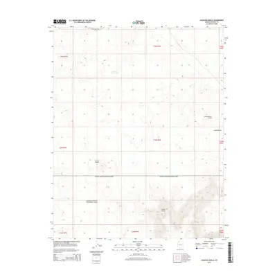
2014 Map of Hancock Knolls
USGS Topo · Published 2014About this map
Grand Canyon National Park extends across the southern half of this landscape, marking a transition from the elevated Kanab Plateau into the dramatic drainage of Tuckup Canyon. This high-desert region in Mohave County is characterized by isolated water sources essential for land management and ranching history, such as White Tank and School Section Tank. The northern reaches of the quadrangle are dominated by the Hancock Knolls, providing a distinct vertical relief against the surrounding plateau. The only major transport artery through this arid interior is Mt Trumbull Rd, which skirts the northern boundary. The map provides a detailed view of the Public Land Survey System, showing the township and range divisions from T34N to T36N that define property and resource boundaries in this part of Arizona.
Find a feature on this map
17 named features on this map. Tap any name to fly to it.
Don’t see what you’re looking for? This feature index may not catch every label — zoom into the map to look around manually.
Map Details
Editions of this 2014 Hancock Knolls Map
This is the sole edition of this map. No revisions or reprints were ever made.
Other maps of this area

1886 · Mt. Trumbull
USGS Topo · 1:250,000

1886 · Kaibab
USGS Topo · 1:250,000

1892 · Mt. Trumbull
USGS Topo · 1:250,000

1953 · Grand Canyon
USGS Topo · 1:250,000

1954 · Heaton Knolls SE
USGS Topo · 1:24,000

1954 · Heaton Knolls
USGS Topo · 1:62,500

1957 · Grand Canyon
USGS Topo · 1:250,000

1958 · Grand Canyon
USGS Topo · 1:250,000

1960 · Grand Canyon
USGS Topo · 1:250,000

1962 · Tuckup Canyon
USGS Topo · 1:62,500