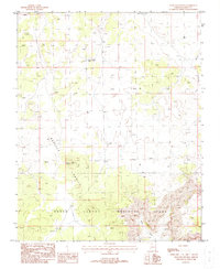
1988 Map of Hancock Knolls
USGS Topo · Published 1988About this map
Grand Canyon National Park occupies the southern and eastern margins of this Arizona landscape, where the plateau drops away into the complex drainages of Tuckup Canyon and Little Robinson Canyon. The topography is defined by the prominent Hancock Knolls, a series of high points including the specific peak at Hancock Knoll. This 1988 provisional survey captures a remote section of Mohave County during a period of land management transition, showing the infrastructure of the ranching era through water features like White Tank and School Section Tank. The mapping emphasizes the relationship between the relatively flat upper plateaus and the sudden, deep incisions of the canyon systems, providing a detailed record of the unimproved trails and livestock tanks that supported desert operations on the Arizona Strip.
Find a feature on this map
1 named feature on this map. Tap any name to fly to it.
Don’t see what you’re looking for? This feature index may not catch every label — zoom into the map to look around manually.
Map Details
Editions of this 1988 Hancock Knolls Map
This is the sole edition of this map. No revisions or reprints were ever made.
Other maps of this area

1886 · Mt. Trumbull
USGS Topo · 1:250,000

1886 · Kaibab
USGS Topo · 1:250,000

1892 · Mt. Trumbull
USGS Topo · 1:250,000

1953 · Grand Canyon
USGS Topo · 1:250,000

1954 · Heaton Knolls SE
USGS Topo · 1:24,000

1954 · Heaton Knolls
USGS Topo · 1:62,500

1957 · Grand Canyon
USGS Topo · 1:250,000

1958 · Grand Canyon
USGS Topo · 1:250,000

1960 · Grand Canyon
USGS Topo · 1:250,000

1962 · Tuckup Canyon
USGS Topo · 1:62,500