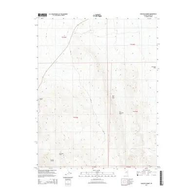
2015 Map of Hancock Summit
USGS Topo · Published 2015About this map
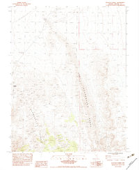
Hancock Summit serves as the focal point of this high-desert landscape in Lincoln County, where the topography is defined by the dramatic convergence of the Mount Irish Range and the East Pahranagat Range. The map reveals the intricate network of ridgelines and canyons that transition into the Pahranagat Valley on the eastern edge. Human presence in this arid environment is marked by utilitarian infrastructure and sparse water sources, such as Cow Camp Spring and the winding path of Badger Rd. The inclusion of the Pahranagat Range in the southwest highlights the complexity of the basin-and-range geology, where elevation changes are sharp and water is a critical, localized resource. This survey captures the area before modern expansion, focusing on the natural landforms and the few essential roads like Repeater Rd that provide access to the remote peaks.
Find a feature on this map
15 named features on this map. Tap any name to fly to it.
Don’t see what you’re looking for? This feature index may not catch every label — zoom into the map to look around manually.
Map Details
Editions of this 2015 Hancock Summit Map
This is the sole edition of this map. No revisions or reprints were ever made.
Other maps of this area

1945 · Alamo
USGS Topo · 1:125,000

1954 · Caliente
USGS Topo · 1:250,000

1959 · Caliente
USGS Topo · 1:250,000

1969 · Alamo
USGS Topo · 1:24,000

1969 · Ash Springs
USGS Topo · 1:24,000

1970 · Hiko
USGS Topo · 1:24,000
1980 · Alamo
USGS Topo · 1:24,000
1983 · Cutler Reservoir
USGS Topo · 1:24,000
1983 · Crescent Reservoir
USGS Topo · 1:24,000
1983 · Hancock Summit
USGS Topo · 1:24,000