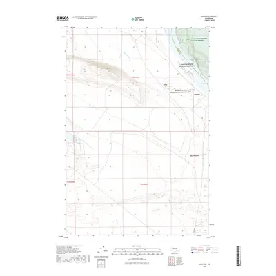
2020 Map of Hanford
USGS Topo · Published 2020About this map
The Manhattan Project National Historical Park preserves a critical era of American nuclear history on this landscape along the Columbia River. This modern survey documents the sensitive geography of the region, where the Hanford Reach National Monument and Saddle Mountain National Wildlife Refuge border the historic Hanford townsite. The terrain is marked by infrastructure related to federal operations, including the US Department of Energy Res Rd and the Hanford Ditch, reflecting the long-term industrial and environmental footprint of the site. While modern conservation and recreation are represented by the Wahluke Walking Trail, the map also preserves the locations of early local place names like May Junction and Edna, providing a spatial record of the area's transition from early 20th-century agriculture and irrigation to one of the most significant government projects in history.
Find a feature on this map
13 named features on this map. Tap any name to fly to it.
Don’t see what you’re looking for? This feature index may not catch every label — zoom into the map to look around manually.
Map Details
Editions of this 2020 Hanford Map
This is the sole edition of this map. No revisions or reprints were ever made.
Other maps of this area

1915 · Prosser
USGS Topo · 1:125,000

1916 · Coyote Rapids
USGS Topo · 1:62,500

1917 · Pasco
USGS Topo · 1:125,000

1917 · Prosser
USGS Topo · 1:125,000

1924 · Hanford
USGS Topo · 1:62,500

1951 · Richland
USGS Topo · 1:62,500

1951 · Hanford
USGS Topo · 1:62,500

1951 · Corral Canyon
USGS Topo · 1:62,500

1951 · Coyote Rapids
USGS Topo · 1:62,500

1953 · Walla Walla
USGS Topo · 1:250,000