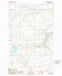
1986 Map of Hanford NE
USGS Topo · Published 1986About this map
The Hanford Site Habitat Management Area dominates this mid-1980s landscape, illustrating the controlled land use surrounding the nuclear production facility. The terrain is defined by the sharp descent of the Wahluke Slope, where agricultural infrastructure meets restricted zones. Water management is central to the area's geography, with the Wahluke Branch Canal and various wasteways cutting through the arid Franklin County soil. Evidence of earlier industrial efforts is visible in the Old RR Grade and a remaining trestle, marking former transport routes across the plateau. Scattered utility markers like a substation, transmission lines, and multiple pumps reflect the heavy engineering required to manage both power and water in this corner of Washington, while a spoil bank and levee show the physical modification of the Wahluke terrain.
Find a feature on this map
21 named features on this map. Tap any name to fly to it.
Don’t see what you’re looking for? This feature index may not catch every label — zoom into the map to look around manually.
Map Details
Editions of this 1986 Hanford NE Map
This is the sole edition of this map. No revisions or reprints were ever made.
Other maps of this area

1923 · Corfu
USGS Topo · 1:62,500

1924 · Othello
USGS Topo · 1:62,500

1924 · Hanford
USGS Topo · 1:62,500

1925 · Scooteney Lake
USGS Topo · 1:62,500

1951 · Scooteney Lake
USGS Topo · 1:62,500

1951 · Corfu
USGS Topo · 1:62,500

1951 · Hanford
USGS Topo · 1:62,500

1953 · Walla Walla
USGS Topo · 1:250,000

1954 · Othello
USGS Topo · 1:24,000

1954 · Othello
USGS Topo · 1:62,500