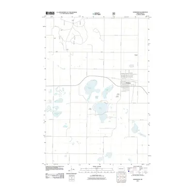
2011 Map of Hankinson
USGS Topo · Published 2011About this map
Hankinson serves as the primary hub in this prairie landscape, where a dense grid of residential streets and avenues like 1st St SE and 10th St SW meets the surrounding agricultural expanse. The area is defined by a significant chain of glacial lakes and wetlands, including the prominent Lake Elsie and the distinctively shaped Horseshoe Lake and Frying Pan Lake. These water bodies are interspersed with rural landmarks that provide deep roots for local genealogy, such as the Coppin Cemetery located west of Lake Elsie and the Immanuel Cemetery to the north. The township-and-range road system, marked by numbered routes like 163rd Ave SE and 95th St SE, creates a geometric framework across the terrain, connecting the outlying farms to the central commerce of the town and its lakeside recreation areas.
Find a feature on this map
60 named features on this map. Tap any name to fly to it.
Don’t see what you’re looking for? This feature index may not catch every label — zoom into the map to look around manually.
Map Details
Editions of this 2011 Hankinson Map
This is the sole edition of this map. No revisions or reprints were ever made.
Other maps of this area

1904 · Wahpeton
USGS Topo · 1:125,000

1907 · Wyndmere
USGS Topo · 1:125,000

1917 · New Effington
USGS Topo · 1:62,500

1953 · Milbank
USGS Topo · 1:250,000

1953 · Fargo
USGS Topo · 1:250,000

1956 · Fargo
USGS Topo · 1:250,000

1958 · Milbank
USGS Topo · 1:250,000

1964 · Hankinson
USGS Topo · 1:24,000

1964 · Mantador
USGS Topo · 1:24,000

1964 · Moselle
USGS Topo · 1:24,000
Featured Places
- Hankinson, ND
- Brightwood Township, ND
- Belford Township, ND
- Greendale Township, ND
- Brandenburg Township, ND