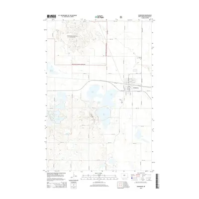
2014 Map of Hankinson
USGS Topo · Published 2014About this map
Hankinson serves as the central hub of this Richland County landscape, situated just east of a dense cluster of prairie lakes and marshes. The town's grid is bounded by a significant rail corridor and provides access to the recreational and agricultural lands surrounding Lake Elsie and Grass Lake. To the northwest, the map transition into the Sheyenne National Grassland, where the terrain becomes more varied with numerous depressions and unique water bodies like Frying Pan Lake and Horseshoe Lake. Genealogists will find several burial sites preserved across the rural townships, including Calvary Cem, Hillside Cem, and the remote Coppin Cem near the western shore of Lake Elsie. The map also documents the transition from the structured streets of the village to the expansive section-line road system that defines the eastern Dakotas.
Find a feature on this map
41 named features on this map. Tap any name to fly to it.
Don’t see what you’re looking for? This feature index may not catch every label — zoom into the map to look around manually.
Map Details
Editions of this 2014 Hankinson Map
This is the sole edition of this map. No revisions or reprints were ever made.
Other maps of this area

1904 · Wahpeton
USGS Topo · 1:125,000

1907 · Wyndmere
USGS Topo · 1:125,000

1917 · New Effington
USGS Topo · 1:62,500

1953 · Milbank
USGS Topo · 1:250,000

1953 · Fargo
USGS Topo · 1:250,000

1956 · Fargo
USGS Topo · 1:250,000

1958 · Milbank
USGS Topo · 1:250,000

1964 · Hankinson
USGS Topo · 1:24,000

1964 · Mantador
USGS Topo · 1:24,000

1964 · Moselle
USGS Topo · 1:24,000
Featured Places
- Hankinson, ND
- Brightwood Township, ND
- Belford Township, ND
- Greendale Township, ND
- Brandenburg Township, ND