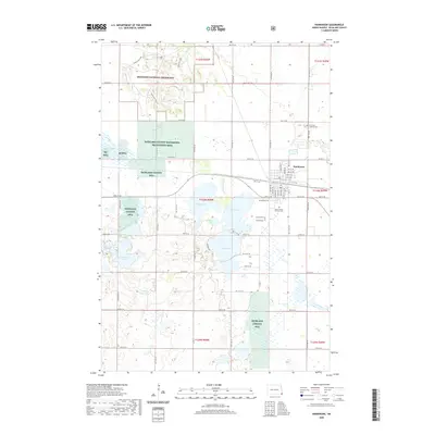
2020 Map of Hankinson
USGS Topo · Published 2020About this map
Hankinson serves as the focal point of this southeastern North Dakota landscape, situated at a junction of roads and rails near a dense collection of prairie lakes and sloughs. The town is flanked by a significant concentration of local heritage sites, including Hillside Cem, Calvary Cem, and the Saint Francis Convent Cem. To the north, the terrain rises into the Hankinson Hills within the Sheyenne National Grassland, while the surrounding plains are dotted with numerous conservation areas like the Richland County Waterfowl Production Area. The hydrology of the region is notably complex, defined by bodies of water such as Lake Elsie, Willard Lake, and the uniquely named Frying Pan Lake. This 2020 survey illustrates a modern rural geography where agriculture, wildlife management at RC Wpa, and the historic town center of Hankinson coexist among the glacial potholes and ridges of the Red River Valley hinterland.
Find a feature on this map
44 named features on this map. Tap any name to fly to it.
Don’t see what you’re looking for? This feature index may not catch every label — zoom into the map to look around manually.
Map Details
Editions of this 2020 Hankinson Map
This is the sole edition of this map. No revisions or reprints were ever made.
Other maps of this area

1904 · Wahpeton
USGS Topo · 1:125,000

1907 · Wyndmere
USGS Topo · 1:125,000

1917 · New Effington
USGS Topo · 1:62,500

1953 · Milbank
USGS Topo · 1:250,000

1953 · Fargo
USGS Topo · 1:250,000

1956 · Fargo
USGS Topo · 1:250,000

1958 · Milbank
USGS Topo · 1:250,000

1964 · Hankinson
USGS Topo · 1:24,000

1964 · Mantador
USGS Topo · 1:24,000

1964 · Moselle
USGS Topo · 1:24,000
Featured Places
- Hankinson, ND
- Brightwood Township, ND
- Belford Township, ND
- Greendale Township, ND
- Brandenburg Township, ND